Landscape Conservation Webinar Series
The Network for Landscape Conservation is pleased to present an ongoing webinar series, Landscape Conservation in Action. The webinars will showcase a wide-ranging set of experts in the field of landscape conservation to share practical reflections, insights, and stories on the “how to” of landscape conservation. Like landscape conservation in practice, these webinars aim to be diverse in scope and approach, and our hope is that they deepen the opportunity for exchange, learning, and dialogue across landscape conservation initiatives throughout North America.
UPCOMING WEBINARS:
VIEW RECORDINGS OF PAST WEBINARS:
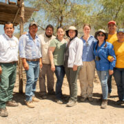
Insights and reflections from Bat Conservation International’s Agave Restoration Initiative, a bi-national landscape-scale initiative to save biodiversity and support rural livelihoods
Tuesday, April 29, 2025
In this webinar, Dr. Kristen Lear of Bat Conservation International (BCI) shares the story of the emergence of BCI’s Agave Restoration Initiative, a bi-national collaborative landscape-scale initiative restoring critical habitat for threatened migratory pollinating bats while supporting sustainable livelihoods across the U.S. and Mexico. Since launching in 2018, the initiative has scaled from two pilot projects to a coordinated initiative with over 65 multi-sectoral partners, planting over 116,000 agaves and restoring or protecting over 5,400 hectares across nine U.S. and Mexican states.
Rather than being treated as a separate, ancillary benefit to bat conservation, human well-being is framed as an integral, foundational strategy for advancing biodiversity outcomes. This is reflected in the initiative’s diverse strategies, which include: creating regional agave supply chains with community and private nurseries; planting agaves to support both bat foraging needs and local livelihoods; implementing regenerative agriculture and ranching and supporting community green enterprises that enhance agave habitat and support local economies; strengthening local conservation and restoration capacity; fostering peer-to-peer learning; and inspiring conservation action through educational programs.
Reflecting on seven years of growth, Dr. Lear will share key factors behind the initiative’s success and offer practical recommendations on: building and sustaining multi-sectoral partnerships; maintaining flexibility to respond to local crises and meet basic community needs before conservation efforts can take root; mechanisms for facilitating peer-to-peer learning that fosters a sense of belonging and shared purpose; integrating agave restoration with broader federal and regional programs; strategies for framing conservation work in ways that resonate with funders; and leveraging storytelling, media, and experiential learning for conservation impact.
For more information about the Agave Restoration Initiative, visit:
BCI’s Agave Restoration Initiative webpage: https://www.batcon.org/our-work/protect-restore-landscapes/agave-restoration/
“We Belong Together” webpage with videos showcasing the interconnectedness of bats, agaves, and people, and the work BCI and partners are doing to protect them: https://www.batcon.org/batsandagave/

In the Right Hands: How trust-based funding practices can advance conservation & stewardship
February 20, 2025 -- 1 pm ET/10 am PT
In a complex, interconnected world, it is increasingly clear that effective, impactful conservation and stewardship outcomes emerge when communities come together to work towards a shared vision for the places that they love. Such work is complicated, can be messy, and should be, above all, grounded in trust. Funders and funding practices have not always recognized the nature of this work–but an evolving practice in trust-based philanthropy is emerging, as a set of values and practices that encourages donors to invest in long-term, flexible funding for the organizations and projects that they are partnering with. Join us for the screening of a short film, produced by Trees, Water, & People, entitled, In the Right Hands: Trusting Community to Guide Philanthropy. Following the 10-minute film, we will invite a panel bringing funder, organization, and community voices from the film into discussion around trust-based practices in conservation and stewardship, with an emphasis on understanding the nature and impact of such practices and the ways in which flexible funding can support them.
Panelists:
- Sebastian Africano, Trees, Water, & People
- Jordana Barrack, Mighty Arrow Foundation
- Chas Robles, Ancestral Lands Conservation
What Does Collaborative Capacity Make Possible? Prevailing Perspectives on the Relationship between Collaborative Capacity and Landscape Stewardship Outcomes
January 31, 2024
Collaborative landscape conservation and stewardship initiatives are increasingly emerging in response to challenges like climate change, biodiversity loss, and environmental justice. Collaboratives represent innovative approaches to filling gaps in governance and making inclusive decisions in situations where the challenges we are facing exceed or overwhelm our current structures, approaches, and abilities. However, to effectively grow and resource these efforts to be effective in confronting our 21st-Century challenges, we need to better understand the “collaborative capacity” that sustains collaborative groups, partnerships, and networks.This webinar will explore the findings of a recent study—commissioned by the California Landscape Stewardship Network and supported by The Stewardship Network and Resources Legacy Fund —that synthesizes perspectives from practitioners, leaders, and funders on what collaborative capacity is and how it leads to improved on-the-ground conservation and stewardship outcomes. Study authors Jaimie Baxter and Seamus Land will share a brief presentation on findings, plus implications and recommendations for practitioners, funders, and researchers that aim to encourage greater coordination and alignment around collaborative capacity. The event will also include an opportunity for participants to ask questions, provide feedback, and engage in discussion amongst one another.
Watershed-Scale Climate Collaboration: Stories from Massachusetts
November 14, 2023
In this webinar, we will explore why watershed-scale climate collaboration is critical for climate adaptation, including addressing flooding and drought, and offering co-benefits for people and nature. We’ll hear stories from collaboratives on-the-ground in Massachusetts, including how they sustain and grow their partnerships as well as how they enhance climate resilience through conservation, stewardship, and restoration efforts. We’ll also explore how we activated this network of collaboratives and highlight how peer-learning opportunities and a new outreach toolkit raise awareness and effectiveness of their work.
Presenters:
- Stefanie Covino, Program Manager, Blackstone Watershed Collaborative;
- Melissa Ocana, Climate Adaptation Coordinator, UMass Extension, University of Massachusetts Amherst
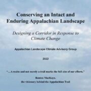
Connect and Protect: Building an Enduring Appalachian Climate Corridor
May 24th, 2023
Speakers:
- Galeo Saintz, International Trails Expert and Conservationist & Founding Chair of the World Trails Network (2012 – 2022)
- Katie Allen, Director of Landscape Conservation,
Appalachian Trail Conservancy - David Lillard, Executive Director, Catoctin Land Trust
For nearly a century, the Appalachian Trail has existed as a backbone of conservation in the eastern United States. The footpath traverses a natural network of connected mountains, forests, rivers, and streams that is critical to adapting to a changing climate. Large-landscape scale conservation has come into focus as the future of the Appalachian Landscape to connect and protect this ecological corridor beyond the footpath of the Appalachian Trail.
This webinar will provide three perspectives on scaling up conservation around trails that can provide for unique opportunities and challenges for protected corridors, ecological systems, biodiversity, and human connection to nature.
From the global perspective, a broader context and international examples will highlight the role of trails in supporting conservation corridors. Unique conservation drivers and partnerships will demonstrate the emerging impacts and trends related to trail projects in consideration of large-landscape scale conservation efforts.
In the US, the Appalachian Trail, considered the world’s longest hiking-only trail, is set in a globally significant landscape with the largest, most resilient stock of forest carbon in the continental US, the most important region of biodiversity and climate resiliency in Eastern North America, and the supplier of water resources to 119 million people. Over the last two years, theAppalachian Trail Conservancy, the Center for Large Landscape Conservation, members of the Appalachian Trail Landscape Partnership, and dozens of other climate and conservation experts have convened to explore ways to enhance the climate resiliency of the Appalachian Trail landscape. What has emerged is the report, Conserving an Intact and Enduring Appalachian Landscape: Designing a Corridor in Response to Climate Change”, providing an inspiring vision for an Appalachian Climate Corridor: a connected and conserved landscape that protects the Appalachian Mountains so people and nature can thrive in an era of climate change.
Lastly, at the granular scale, we will also learn how a Maryland land trust and regional partnership is using the report to create a local action plan for landscape connectivity. Highlights will demonstrate how community-led efforts to integrate climate-smart actions into conservation strategies and strategic planning efforts can advance climate resiliency in the Appalachians through collaborative landscape conservation at the local level.
Crowdsourcing Global Stewardship Solutions: Lessons from Connecting Australia and U.S. Practitioners
May 2, 2023
Speakers:
- Shelana deSilva, SdS consulting & California Landscape Stewardship Network
- Deb Davidson, Center for Large Landscape Conservation
- Jody Gunn, Australian Land Conservation Alliance
- Cecilia Riebl, Trust for Nature
Worldwide people are coming together to steward the landscapes communities depend upon for clean air and water, sustenance, and joy. And yet, many stewardship practitioners continue to struggle alone with the common challenges of funding, capacity, and disconnection between nature and one another. By connecting practitioners doing collaborative stewardship in diverse contexts, we can accelerate learning and problem solving, making place-based work scale up to a much-needed movement for inclusive, effective stewardship. In October 2022, 10 landscape stewardship practitioners from the western U.S. co-convened a peer exchange with dozens of conservation organizations across eastern Australia. Three weeks of meetings, conversations, and field time, resulted in shared stewardship practices and cultural perspectives, along with lasting relationships.
Join us for the next NLC webinar to connect with stewardship leaders from Australia and the U.S to learn about the impact of this peer exchanges and explore future opportunities to connect stewardship practitioners around the globe.
A report summarizing lessons from the 2022 Australia exchange is now available on the Global Landscape Stewards webpage here.
Biosphere Regions - Act Globally, Cooperate Locally
March 28, 2023
Presenters:
-
-
- Cliff McCreedy, Science Applications Coordinator, National Park Service
- Samuel Cuthell, Network Coordinator, Golden Gate Biosphere Network
-
The US Biosphere Network represents 28 biosphere regions recognized by the World Network of Biosphere Reserves of UNESCO for their high biodiversity and potential for equitable and sustainable livelihoods. Each biosphere region is designed to enhance ecological connectivity at scale across protected areas and private lands where people live and work. They connect people, nature, and communities across 48 million acres of US lands and waters that contain rich species assemblages and habitats and rural economies. Speakers will review how biosphere regions are learning to integrate socioeconomic and environmental concerns and provide a case study from Golden Gate Biosphere Network for climate change vulnerability assessment.

Insights into the new Global Biodiversity Framework – Impacts and what happens next.
February 22, 2023
Presenters:
- Deb Kmon Davidson, Vice President for Partnerships and Advancement, Center for Large Landscape Conservation & Interim Associate Director, Network for Landscape Conservation
- Aaron Laur, International Connectivity Program Manager, Center for Large Landscape Conservation
In December 2022, the world came together at the United Nations Biodiversity Conference (COP-15) in Montreal to adopt the Kunming-Montreal Global Biodiversity Framework. This framework is the most significant agreement to date for bolstering global cooperation to conserve and restore nature. As we work to advance landscape conservation and stewardship outcomes in North America, what lessons can we learn from colleagues around the world, and what lessons can we share from the U.S.? This webinar will explore what emerged from the negotiations and reflect on what it means for landscape conservation practitioners for integrating and accelerating efforts like America the Beautiful Initiative and/or 30×30 to enhance our work at scale.
America’s Longleaf – A forestry collaborative working at multiple scales for success.
October 5, 2022
Presenters:
- Colette Degarady, Longleaf Pine Whole System Director, The Nature Conservancy
- Stephanie Hertz, Project Manager, Texas A&M Natural Resources Institute
- Kyle Jones, Regional Longleaf Restoration Coordinator, Unites States Forest Service
- Deborah Maurer, SE NC Program Director, The Nature Conservancy
The southeastern forestry partnership, America’s Longleaf, has been working for more than 10 years to restore and maintain longleaf pine forests in the southeast. It started with a Conservation Plan and a common vision with a group of partners. Since the partnership began, more than 1.6 million acres of longleaf pine forests have been planted, 15 million acres of prescribed fire accomplished, and 325,294 acres of longleaf habitat protected through fee and easement acquisitions. The successful elements of this collaboration help increase biodiversity, build wildfire resistant forests, offer economic benefits to private landowners, enhance military installations, and improve the resilience of the southeast in the face of a changing climate.
PARTNER WEBINAR SERIES: Wildlife and the Bipartisan Infrastructure Law
May & June 2022
ARC Solutions, the Center for Large Landscape Conservation, the National Parks Conservation Association, and Wildlands Network present this webinar series designed to raise awareness about wildlife infrastructure, including new and expanded funding opportunities made possible by the Infrastructure Investment and Jobs Act.
New Maps of Imperiled Species Distributions Can Support Landscape Conservation in the Conterminous United States
April 20, 2022
Presenter:
- Dr. Healy Hamilton, Chief Scientist, NatureServe
One of the primary objectives of many landscape conservation efforts is to safeguard habitats for species that are at-risk of extinction. Some incentives to support landscape conservation are based on demonstrating protection for imperiled species, such as ESA listed species, or state-designated Species of Greatest Conservation Need (SGCN). However, many imperiled species distributions are poorly known, particularly for taxonomic groups other than terrestrial vertebrates. Newly published spatial analyses led by NatureServe, in partnership with Esri and TNC, provide the first high resolution view of where our nation’s most imperiled species are found, including not just vertebrates but also over 1500 vascular plants, dozens of pollinators, and hundreds of crayfishes and mussels. Leveraging nearly 50 years of high quality occurrence data collected by the nation’s Natural Heritage Programs, NatureServe, the Natural Heritage Network, and partners developed species habitat models for over 2200 at-risk plants and animals in the conterminous US. The individual maps were then stacked and analyzed to produce spatially-explicit indicators of conservation value for our nation’s most imperiled species. In this webinar, Dr. Healy Hamilton, Chief Scientist at NatureServe, will provide case studies of how landscape conservation efforts can leverage these spatial biodiversity data, such as assessing the degree of overlap with areas of unprotected range-restricted imperiled species.
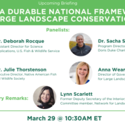
PARTNER WEBINAR: Building a Durable National Framework for Large Landscape Conservation
March 29, 2022
The Environmental and Energy Study Institute convened a policy briefing on building a durable national framework for large landscape conservation. Moderated by Lynn Scarlett [Former Deputy Secretary of the Interior and a Coordinating Committee member of the Network for Landscape Conservation], the briefing featured panelists:
- Dr. Deborah Rocque, Assistant Director for Science Applications at the U.S. Fish & Wildlife Service;
- Dr. Julie Thorstenson, Executive Director of the Native American Fish and Wildlife Society;
- Anna Wearn, Director of Government Affairs for the Center for Large Landscape Conservation;
- Dr. Sacha Spector, Program Director for the Environment at the Doris Duke Charitable Foundation.
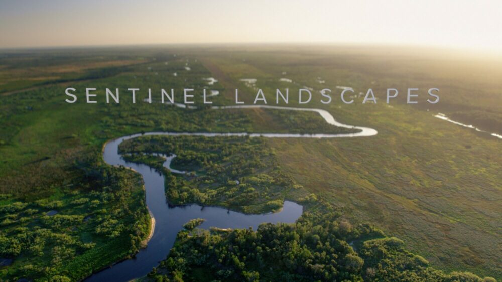
The Sentinel Landscapes Partnership: Advancing Sustainable Management of Private Lands at the Landscape Scale
February 17, 2022
Presenters:
- Kristin Thomasgard, REPI Program Director, Office of the Assistant Secretary of Defense for Sustainment
- Todd Holman, Camp Ripley Sentinel Landscapes Coordinator
- Josh Pennington, Camp Ripley Environmental Supervisor
Learn more about the Sentinel Landscapes Partnership, an interagency partnership that coordinates landscape-scale conservation efforts around our Nation’s military installations. Through a multi-agency Federal Coordinating Committee, these partnerships support efforts at the local level to achieve collaborative work to advance Sentinal Landscape Implementation Plans. These plans advance collective goals and objectives that support compatible land use around military bases and are the foundation for building strong relationships with various partners across these landscapes. The panelists will explore and examine best practices on how to coordinate similar partnerships elsewhere.
Sharing the View from Above: Enabling Collaborative Remote Monitoring for Landscape Conservation
January 11, 2022
Presenters:
- Jake Faber, Lens Growth & Partnerships Manager, Upstream Tech
- Ethan Inlander, Project Director – Stewardship and Restoration, The Nature Conservancy in California
As satellite and aerial imagery become more accessible and widespread, conservation organizations are seeking new ways to incorporate these technologies into their work. Remote sensing offers powerful insights for monitoring protected areas, targeting conservation priorities, and assessing restoration efforts. It can be challenging, however, for organizations to use these tools effectively and collaboratively with partners. On January 11th at 1 pm ET, join the Network for Landscape Conservation for a webinar with Upstream Tech and the Nature Conservancy in California to explore how they are making remote sensing easy to use for conservation organizations of all capacities.
Upstream Tech will give an introduction to remote sensing for conservation, highlighting examples of how they make these tools accessible for land trusts, NGOs, and state and federal agencies through their web platform Lens. Lens aggregates satellite, aerial, and environmental data into a powerful workflow for collaborative analysis and reporting, enabling conservation organizations to work together to increase the pace, scale, and impact of their work. Upstream Tech will then share short case studies of how they are supporting public-private partnerships and coalitions across the country to collaboratively use Lens. The Nature Conservancy in California will also share examples of how they helped develop and scale the use of remote monitoring across the state and with partners nationwide.
Legal Protections for Large Landscape Conservation
December 9, 2021
Presenters:
- Susan Holmes, Federal Policy Director, Wildlands Network
- Erin Sito, U.S. Public Policy Associate, Wildlands Network
- Julie Thorstenson, Executive Director, Native American Fish & Wildlife Society
- Zack Wurtzebach Ph.D., Corridors and Crossings Program Director, Center for Large Landscape Conservation
Speakers will discuss legislative and regulatory matters that impact large landscape conservation with a focus on wildlife corridors and connectivity. This will include legal protections on:
- Federal and public lands, focusing on current regulatory tools and statutes that would give the US Forest Service authority to engage in habitat connectivity planning and a discussion of the potential protections via a federal Wildlife Corridor bill.
- A brief summary of recent State legislative successes.
- Tribal Lands, focusing on the Tribal Wildlife Corridor Act and other legislative priorities for Tribes to support large landscape conservation and habitat connectivity.

An in-depth look at the Southeast Conservation Adaptation Strategy (SECAS) & the Southeast Conservation Blueprint
November 10, 2021
Presenters:
- Hilary Morris, Blueprint User Support & Communications, U.S. Fish & Wildlife Service
- Mallory Martin, SECAS Coordinator, U.S. Fish & Wildlife Service (Unable to Attend)
- Shawn Johnson, Managing Director, Center for Natural Resources and Environmental Policy: University of Montana (Network Co-Chair)
This webinar will describe the evolution, implementation, and future direction of the Southeast Conservation Adaptation Strategy (SECAS), a collaborative landscape partnership focused on designing and achieving a connected network of lands and waters to sustain thriving fish and wildlife populations and improve quality of life for people in light of rapid changes in the Southeast, including urbanization and climate change.
The Southeast Conservation Blueprint is the primary product of SECAS and provides a collaboratively developed approach, involving diverse stakeholders and partners, to prioritize and focus conservation actions strategically on the landscape, incorporating key concepts of connectivity, buffering, and linkage to promote biodiversity and sustain the integrity of ecosystems and the services they provide (e.g., clean air, abundant clean water, natural areas for recreation and enjoyment, etc.).
SECAS provides value to its partners as a regional forum for collaboration and as a science and information hub throughout 15 states and portions of the Caribbean to inform conservation decisions across jurisdictions.
Large Landscape Perspectives on Conserving the Arizona-Sonora Borderlands
October 27, 2021
Presenter: Juan Carlos Bravo, Mexico Program Director, Wildlands Network
This webinar will introduce the challenges and opportunities of land protection in Mexico to address the obstacles of connectivity at a regional scale. Juan Carlos Bravo will present how the Wildlands Network addresses these obstacles by focusing on the jaguar, a species that inspires cooperation and brings together stakeholders from Mexico and the United States. By engaging a diversity of stakeholders across jurisdictional boundaries, the Wildlands Network will share how they fill gaps in knowledge through collaborative field research and combat the challenges of connectivity to conserve the Arizona-Sonora Borderlands.
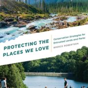
Protecting the Places We Love: Conservation Strategies for Entrusted Lands and Parks
October 7, 2021
Presenter: Breece Robertson, Director of Partnerships and Strategy, Center for Geospatial Solutions, Lincoln Institute of Land Policy
Protecting special places in danger of being changed forever requires urgent action. It’s time for bold conservation strategies to boost land protection around the world. Bold conservation goals require strategic action.
In this presentation, conservationist and geospatial designer Breece Robertson will discuss the vision, strategies, and resources laid out in her new book Protecting the Places We Love: Conservation Strategies for Entrusted Lands and Parks. The goals of these strategies are familiar: support species, habitats, and natural resources and healthy, livable communities that are climate resilient and socially cohesive, all without high costs. To achieve this vision Robertson shares how to:
- create maps that tell compelling stories to stakeholders and the public
- analyze park system equity and access and show the economic benefits
- map, model, and analyze land characteristics to enhance biodiversity, connectivity, and climate resilience
- use maps and data to gain insights for fundraising, program initiatives, policy, advocacy, finances, and marketing.
Robertson offers a vision for success and clear guidance for conservation groups large and small to achieve their goals. With smart analysis and targeted action, our community can identify places needing protection and better understand how to maximize partnerships, inspire, educate, and engage communities and donors, and produce better results.
Focusing for Success: How the San Juan-Chama Watershed Partnership has used a focal area framework to prioritize and track restoration and stewardship projects at the landscape scale
August 11, 2021
Presenters:
- Page Buono, Coordinator, San Juan Chama Watershed Partnership
- Mary Stuever, Chama District Forester, New Mexico State Forestry Division
- Caleb Stotts, Executive Director, Chama Peak Land Alliance
Successful landscape-level restoration and stewardship require a process for strategically targeting treatments to the highest-impact portions of the landscape. This challenge is particularly acute at the landscape level because landscapes almost always span jurisdictional boundaries and contain numerous partners implementing restoration and stewardship efforts. How can you efficiently prioritize across boundaries, and how can you systematically track projects across a range of partners?
In the Rio Chama Watershed along the Continental Divide in southern Colorado and northern New Mexico, the San Juan-Chama Watershed Partnership set out to limit random acts of restoration and further align partner efforts by designing a process for identifying focal areas within their landscape and cataloging projects within those focal areas. Developed in alignment with the New Mexico State Forest Action Plan, the simple, intuitive framework identifies and tracks progress in focal areas. This framework has been celebrated at the State level and adopted by additional collaboratives across the State. During this webinar, the San Juan-Chama Watershed Partnership coordinators will explain their focal area framework and highlight how they’ve rolled it out with their partnership. They will discuss how their work has rippled beyond their landscape to inform how other partnerships prioritize and track progress on restoration at the landscape scale.
Connecting Main Street to Mountaintops: Urban land protection as part of a comprehensive landscape conservation strategy
June 24, 2021
Presenters:
- Danielle Denk, National Green Schoolyards Initiative Lead
- Linda Hwang, Director of Strategy and Innovation
- Robert Kent, Texas State Director
- Michael Giammusso, National Lands Initiative Lead
A comprehensive approach to landscape conservation must include urban spaces and communities, as much as it includes large wild places and rural communities. For nearly fifty years, The Trust for Public Land has been a leader in land protection and park creation, working with communities across the American landscape to advance equity, health, and climate resilience. Leaders from TPL’s parks and schoolyards teams will share insights on effective strategies for using park creation, spatial analysis, and community engagement as part of a conservation approach that strengthens and improves the livability of our cities while connecting them to a larger surrounding landscape that spans regional and, ultimately, national borders.
Collaborative Landscape Conservation Planning: Fostering local stakeholder engagement
June 9, 2021
Presenter: Catherine Doyle-Capitman, National-Level Social Scientist, USDA Forest Service
Natural resource practitioners are increasingly taking a collaborative, landscape-level approach to natural resource conservation. Despite its potential advantages, this approach faces challenges. Primary among these is ensuring ecosystem-wide goals for conservation can effectively inform local management plans and actions. This necessitates working with local stakeholders. Opportunities for local stakeholders to participate in landscape conservation planning are often limited, in part because conservation leaders are uncertain about whether, when, and how these stakeholders might most effectively participate in decision processes.
In this presentation, Catherine Doyle-Capitman will provide an overview of best practices for engaging local stakeholders and incorporating social data during collaborative landscape conservation planning. An overview of these best practices can be found in the following practitioners’ guide: Facilitating Local Stakeholder Participation in Collaborative Landscape Conservation Planning.
Cougars, Corridors, and Conservation: Three decades of expanding vision and partnerships
May 26, 2021
Presenter: Paul Beier, Conservation Research Fellow, Center for Large Landscape Conservation
Drawing upon his more-than-thirty-year career designing and conserving wildlife corridors, Paul Beier, a Conservation Research Fellow with the Center for Large Landscape Conservation and formerly the Regents Professor of Conservation Biology at Northern Arizona University, will share insights into translating connectivity research into conservation action:
During a study of cougars in rapidly urbanizing southern California (1988-1992), I documented that dispersing cubs could find and use narrow corridors through urban areas, and my population model showed the importance of connectivity. Since then, I have been learning how to translate this science into conservation action. The key lessons were that fighting fragmentation is less effective than implementing a linkage design (duh!), and that scientists can be effective leaders only if we get local conservation practitioners to invite us to participate in their real-world work. This work involves workshops to identify 10 to 20 focal species per linkage, identifying barriers and chokepoints, and writing (nay, implementing!) plans that integrate the goals of conservation, economic development, and social justice. These efforts are not just slowing down the rate at which things get worse (“mitigation”), but are creating landscapes more permeable to wildlife than what we have today.
LightHawk: Using Aviation for Landscape Conservation
April 21, 2021
*Apologies that this recording is missing the first three minutes of the presentation. Please be in touch with Esther Duke at [email protected] with questions or to reach out about Lighthawk services.
View Recording
Presenters:
Ryan Boggs, Chief Program Officer, LightHawk
Esther Duke, Western Program Officer, LightHawk
Founded in 1979, the conservation nonprofit LightHawk is the largest environmental flying organization in the country. We engage our network of more than 300 volunteer pilots to provide hundreds of flights each year. Working with more than 100 conservation partners, we help solve pressing river, ocean, land and wildlife problems.
LightHawk is donating flights to advance the work of Network for Landscape Conservation’s members. LightHawk flights can advance your conservation mission in many ways. Flying is often the best way to demonstrate the scope and potential impact of your initiative to:
· Legislators and policy-makers
· Key corporate partners and other stakeholders
· Foundation program officers and major donors
· Journalists and other media
Flights can also enable you to survey wildlife, monitor conservation easements, photograph your landscape, and even transport wildlife to support species recovery efforts. LightHawk provides customized conservation flight planning, planes, pilots, and advice on photography. Flights are available in Canada and Mexico as well as the U.S.
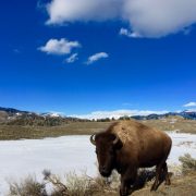
Does Advancing a Large Landscape Vision Lead to Measurable Conservation Advances? 25 Years into the Yellowstone to Yukon Conservation Vision
April 7, 2021
Presenter: Jodi Hilty, President and Chief Scientist of Y2Y
Founded in 1993, the Yellowstone-to-Yukon vision was one of the earliest large landscape conservation visions — an interconnected system of wildlands stretching from Yellowstone to Yukon, harmonizing the needs of people with nature. Many have suggested that they are inspired by this ambitious vision, but wondered whether the vision has had any real impact given that conservation advances are generally more localized.
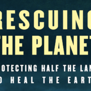
Rescuing the Planet: Protecting Half the Land to Heal the Earth
April 1, 2021
The Network for Landscape Conservation was pleased to host award-winning author and veteran New Yorker contributor Tony Hiss for a conversation about his latest and just-published book, “Rescuing the Planet: Protecting Half the Land to Heal the Earth.” Tony was joined in the discussion as well by Valerie Courtois, Director of Canada’s Indigenous Leadership Initiative, whose work is featured in the book, and Brenda Barrett, editor and founder of the Living Landscape Observer and member the Network’s Coordinating Committee.
We are also pleased to partner with the Country Bookshelf, an independent bookstore in Bozeman, MT to make signed copies of Tony’s book available.
Purchase a signed copy of Rescuing Half the PlanetPartner Spotlight: The NPS Connected Conservation Webinar Series
The Network partners with the National Park Service to showcase the NPS Connected Conservation webinar series (formerly the Scaling Up webinar series). Monthly webinars highlight topics and tools aimed at furthering the practice of landscape conservation. Explore the webinars – both the archived past webinars and upcoming scheduled webinars – to hear about innovative work underway across the continent. The schedule for upcoming NPS Connected Conservation webinars is available here.
Sign up for the NPS Connected Conservation Newsletter
Connected Conservation webinars are recorded; explore past webinars on the NPS Connected Conservation website or in the below archive.
Recorded Connected Conservation webinars from 2019
- Conserving the Trail of Tears National Historic Trail. July 17, 2019
- Eco-Logical: An Ecosystem Approach to Developing Infrastructure Projects. June 27, 2019
- Connectivity and the North Country National Scenic Trail. June 11, 2019
- The High Divide Collaborative: Landscape-Scale Conservation through Community-Based Collaboration. May 1, 2019
- Trust for Public Land’s Landscape Conservation Efforts. April 17, 2019
- Operation Pollination: Using National Heritage Areas to Help Pollinators. April 4, 2019
- Wildlife Connectivity Near Great Smoky Mountains National Park. March 20, 2019
- Light Pollution: The Evolution of Dark-Sky Conservation. March 6, 2019
- Natural Sounds and Night Skies Division of NPS. February 14, 2019
Recorded NPS webinars from 2018
- Connected Conservation for Bats: A Collaborative Model for the Pacific West. October 3, 2018
- Rights of Way, Roads, and Pollinators. September 20, 2018
- Protecting long distance migrations in the Greater Yellowstone Ecosystem. August 29, 2018
- The Wild and Scenic River System. July 10, 2018
- Engaging Local Stakeholders as We Scale Up Conservation. June 25, 2018
- Conserving the Pacific Crest National Scenic Trail. June 20, 2018
- Ecosystem Services Identification and Inventory. May 2, 2018
- The National Trails System: A Collaborative Landscape. April 18, 2018
- Heart of the Rockies Initiative — Invasive Species Distribution in the Crown of the Continent: What does the future hold? March 7, 2018
- Adventure Scientists: Data. You Need It. We Get It. February 7, 2018
- One Tam and the Golden Gate National Park Conservancy — Tales from a Mountain: 12 Key Lessons to Make Partnership Thrive January 24, 2018
Recorded NPS webinars from 2017
- The Yellowstone to Yukon Conservation Initiative: A 2000 Mile Landscape November 14, 2017
- NPS Rivers, Trails, and Conservation Assistance (RTCA) Program and Landscape Conservation October 18, 2017
- Landfire: Tools and Data for Large Landscape Management September 20, 2017
- The Los Angeles Wildlife Crossing Project September 11, 2017
- Hawai’i Volcanoes National Park and the Three Mountain Alliance: Approaches to Landscape Management August 23, 2017
- NatureServe: Explore Natural Communities Project August 15, 2017
- Landscope Chesapeake – Bringing Together Maps, Data, and Stories with NatureServe July 19, 2017
- Mitigation Banking in the National Park Service: The Mitigation Banking Initiative June 21, 2017
- Mapping the Indigenous Cultural Landscape May 11, 2017
- The UNESCO Biosphere Reserve Program March 15, 2017
- Confederated Salish and Kootenai Tribe of the Flathead Reservation: Climate Change Strategic Plan January 18, 2017
Recorded NPS webinars from 2016
- The National Natural Landmarks Program November 9, 2016
- Section 106 Undertakings: Historic Properties in Landscape Scale Planning September 22, 2016
- The Conservation Fund August 17, 2016
- Service First Agreements to enhance landscape conservation February 17, 2016
Recorded NPS webinars from 2015
- Studying Birds in the Context of the Annual Cycle: The Migratory Connectivity Project December 9, 2015
- International Connectivity Conservation: Case Studies November 4, 2015
- The Nature Conservancy: Scaling Up Tools October 15, 2015
- Using Landscape Conservation Cooperatives to Build a Connected Conservation Network September 9, 2015
- Landscape Conservation: Approaches and Experiences from the National Parks Conservation Association August 12, 2015
- NPSpecies: An Overview July 15, 2015
- NPS General Authorities for working beyond Park Boundaries May 18, 2015
- Landscape Conservation: Partnering with Land Trusts April 16, 2015