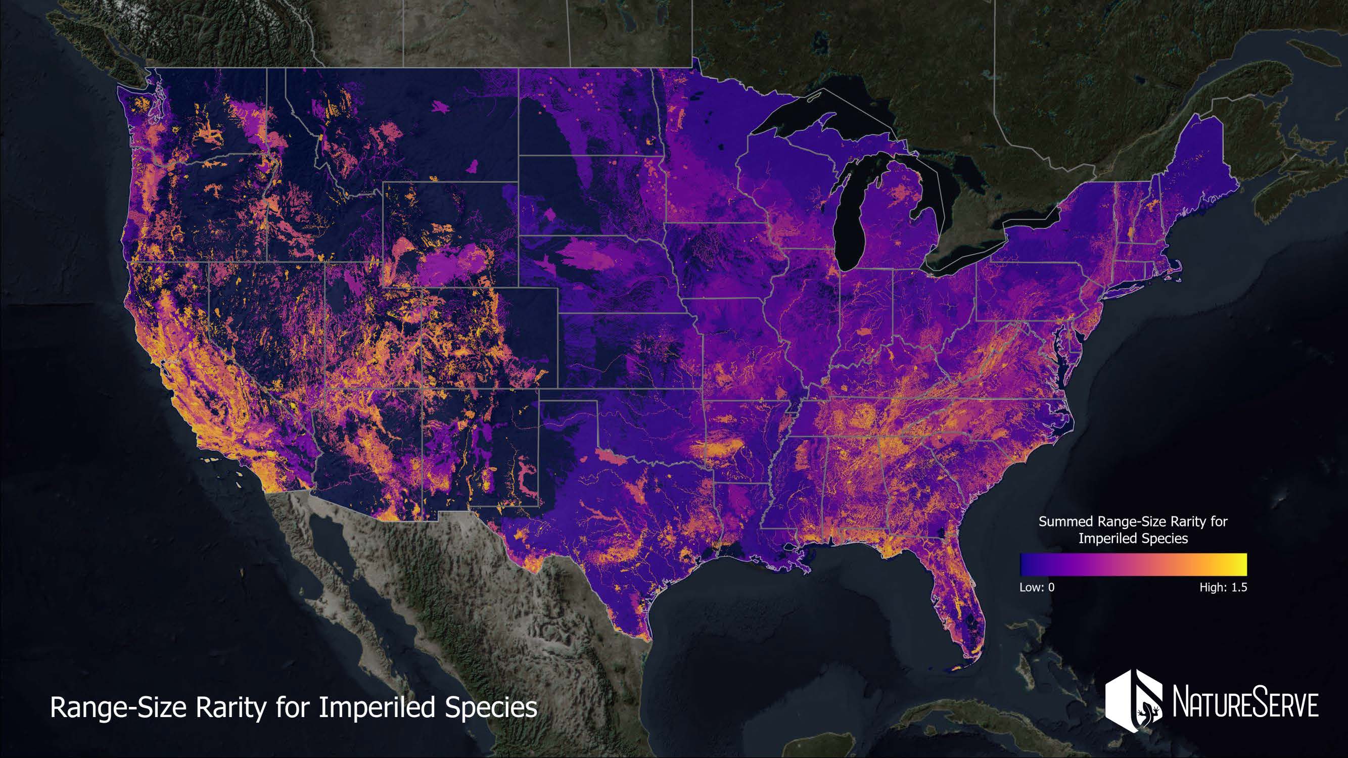
Webinar Next Week: New Maps of Imperiled Species Distributions Can Support Landscape Conservation in the Conterminous United States
Please join us for our next conversation in the Network’s ongoing Landscape Conservation in Action webinar series – Wednesday, April 20th, at 4:00 pm (ET). The Network is honored to host Dr. Healy Hamilton, Chief Scientist at Nature Serve to discuss new research that unveils a high-resolution view of where to protect our nation’s most imperiled plants and animals. The study, led by NatureServe with partners from Esri, The Nature Conservancy, and the NatureServe Network, offers an unprecedented, fine-scale map of the places that matter most for sustaining our nation’s biodiversity. Learn more about the study here.
Webinar Title: New Maps of Imperiled Species Distributions Can Support Landscape Conservation in the Conterminous United States
Description: One of the primary objectives of many landscape conservation efforts is to safeguard habitats for species that are at risk of extinction. Some incentives to support landscape conservation are based on demonstrating protection for imperiled species, such as ESA-listed species or state-designated Species of Greatest Conservation Need (SGCN). However, many imperiled species distributions are poorly known, particularly for taxonomic groups other than terrestrial vertebrates. Newly published spatial analyses led by NatureServe, in partnership with Esri and TNC, provide the first high-resolution view of where our nation’s most imperiled species are found, including not just vertebrates but also over 1500 vascular plants, dozens of pollinators, and hundreds of crayfishes and mussels. Leveraging nearly 50 years of high-quality occurrence data collected by the nation’s Natural Heritage Programs, NatureServe, the Natural Heritage Network, and partners developed species habitat models for over 2200 at-risk plants and animals in the conterminous US. The individual maps were then stacked and analyzed to produce spatially-explicit indicators of conservation value for our nation’s most imperiled species. In this webinar, Dr. Healy Hamilton, Chief Scientist at NatureServe, will provide case studies of how landscape conservation efforts can leverage these spatial biodiversity data, such as assessing the degree of ov
.Presenter:
- Healy Hamilton, Ph.D. – Chief Scientist, NatureServe
